High-Performance Computing Center Stuttgart


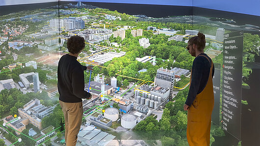
Researchers at HLRS have in recent years demonstrated a number of applications of digital twins that are relevant for environmental management, including for city and regional planning. Digital twins developed at HLRS have combined geographic and building data, mobility data, environmental information, sensor data, citizen feedback, and other data types into immersive, interactive visualizations. When presented in a virtual reality facility like HLRS's CAVE, professionals, public officials, and the general public can more easily understand the potential effects of planning interventions in their communities, communicate with one another about them, and ultimately identify solutions that balance the diverse needs and interests of everyone affected by them.
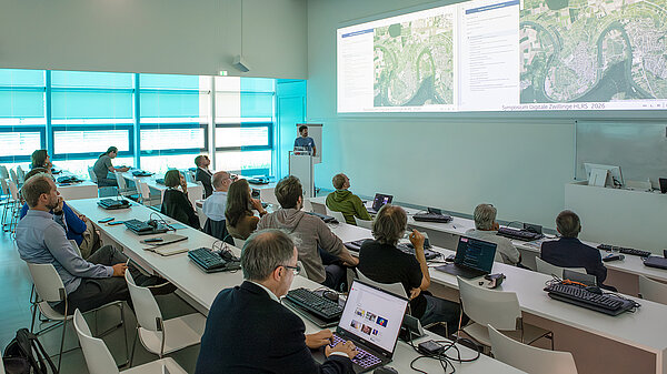
Building on this experience, the symposium at HLRS brought scientific experts in digital twins from multiple universities together with representatives of public agencies and small enterprises to discuss current applications of the approach, as well as the challenges and opportunities facing the field. The topics discussed extended beyond the field of city planning, focusing on applications of digital twins for climate and weather modeling, landscape management, infrastructure development, and disaster prevention. Together, the talks and the discussions they prompted illuminated how digital twins could help make our cities, industry, and landscapes more sustainable.
With European and national laws mandating the reduction of greenhouse gas (GHG) emissions, communities across Europe have been working on strategies to meet emissions reduction targets. As Prof. Kimmo Lylykangas, Professor and Head of the Academy of Architecture and Urban Studies at Tallinn University of Technology, explained in a keynote talk, however, this can be a vexing problem.
Before reducing GHG emissions, communities must account for the emissions they produce. How to do so is not a straightforward question, as emissions can result from the manufacture and import of goods from outside the community. At the same time, emissions are not evenly distributed across a city but can be driven by the activities of specific industries or companies, individual residents or specific neighborhoods, or the functioning of a city as a whole. Only by gaining a clearer understanding of this complex system can communities identify interventions that will have the greatest impact, as well as the potential side effects of those actions.
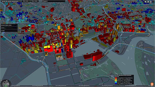
To enable a more informative accounting of GHG emissions in communities, Lylykangas proposed a concept in which emissions data would be tagged with metadata and represented within a digital twin. This would make it possible, he suggested, to integrate and compare multiple perspectives on emissions scenarios, and to better characterize GHG emissions sources at multiple layers of granularity. This would empower local policy makers to identify more impactful strategies for mitigating emissions, increasing carbon sequestration, and reducing emissions resulting from the city's supply chains. Concluding his talk, Lylykangas encouraged experts in digital twins to dive into this problem and develop a more useful tool for modeling emissions scenarios.
In the next talk, Andres Maremäe explained how the City of Tallinn, Estonia, is using digital twins for real-time city management. "A digital twin is not a visualization, but a data flow," he argued. In Tallinn, city management is constantly collecting real-time data about infrastructure and operations. Using cameras mounted to garbage trucks, for example, the city can use artificial intelligence to produce traffic alerts or to detect damage to roadways. Such use cases have enabled Maremäe's team to demonstrate the value of investing in digital twins, and improve the city's ability to respond more quickly to changing conditions.
As work at HLRS is demonstrating, digital twins also offer powerful tools for building community understanding, dialogue, and consensus in the planning of energy transformation. As a partner in the Stuttgart Research Initative DiTEnS, HLRS has been testing how digital twins rendered in virtual reality can support participatory planning of new, more sustainable energy and heating concepts. As HLRS scientist Kilian Türk explained at the symposium, the DiTEnS team recently completed its first study, which focused on the development of a new energy and heating concept at the University of Stuttgart's Vaihingen campus. HLRS created a digital twin that integrated photogrammetry data, blueprints of the university's heating network, building data, building information model (BIM) data, and a point cloud laser scan of new heat piping, together with simulation data of the campus' energy system. Presented using virtual reality, it served as a basis for workshops that brought together stakeholders to collect suggestions, discuss options, and plan the university's transition toward carbon neutrality.
In the coming months, DiTEnS will begin a new pilot study focusing on a neighborhood in Stuttgart. A digital twin developed at HLRS will support local residents and other stakeholders in evaluating options for a more sustainable heating infrastructure.
Multiple talks at the HLRS symposium also explored how digital twins can help protect the health of important regional and local landscapes. One dedicated session explored how digital twins could support landscape preservation of vineyards on the terraced hills along the Neckar River. As environmentalist Claus-Peter Hutter, local wine-growers, and public officials explained at the symposium, this heritage landscape has been cultivated for hundreds of years, and holds great importance in local communities for both economic and cultural reasons. Due to climate change, demographic shifts, and changing economic conditions, however, the Neckar wine industry struggles to survive.
As HLRS visualization scientist Thomas Obst explained, HLRS has been working with the district of Ludwigsburg and winegrowing startup ExNicrum to develop a digital twin of the terraced Neckar vineyards near Hessigheim. The model combines photogrammetry data captured using an aerial drone to create a three-dimensional model of the steep hillside landscape in virtual reality. Using AI-supported visual recognition software, data from drone flights taken over several months can be compared to identify specific locations in the vineyards that are undergoing erosion. The digital twin also makes it possible to simulate how water flows down the hillside during heavy rainfall events, which could be used to identify and reinforce areas at danger of landslide. In addition, it enables sun exposure analyses, which could help in optimizing the selection and placement of grape varieties in light of environmental changes or for assessing the potential of the hills for other uses, such as solar power generation.
Additional talks at the HLRS symposium considered other applications for landscape preservation as well. Andreas Hänsler, professor of hydrology at the University of Freiburg, described his lab's work to improve prediction of flooding following heavy rainfall events in the Black Forest. The researchers have developed a digital twin that combines topographic, hydrological, and meteorological factors, and aim to support real-time, high-resolution early warning of flash floods to forecast potential property damage.
Julian Frey, also a professor at the University of Freiburg, introduced an approach that uses digital twins for forest management. Using drones and laser scanners, his team collects high-resolution data of forests that captures not only the distribution of tree species, but also other data concerning dryness and wildfire risk. The digital twin enables them to test scenarios in order to support more efficient forest management planning under changing climate conditions.
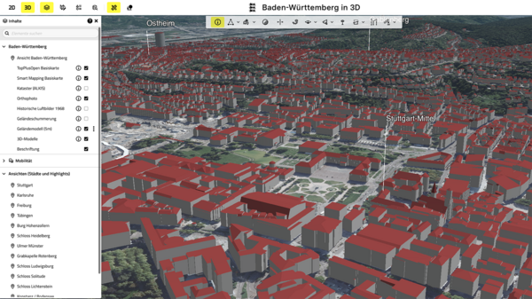
As research using digital twins advances, larger, general models are becoming foundations upon which more localized simulations can be built. As Marvin Schmidt explained, the Baden-Württemberg State Office for Geoinformation and Land Development has developed a digital twin called geoZwilling@bw, which offers a high-resolution digital model of the entire state. The model is regularly updated as new buildings are constructed, offering a toolbox of reliable data that can be used for the development of other simulations or scenario testing.
As University of Hohenheim physicist Thomas Schwitalla explained at HLRS, today's supercomputers make it possible to simulate weather and climate globally, and at increasingly fine-scaled resolution. By combining data representing the atmosphere, land topography, oceans, waterways, vegetation, and other features, global weather and climate models are improving scientists' ability to make fact-based projections about the future effects of climate change, even down to the regional and local levels. Such information will improve the ability of cities and communities to anticipate and prepare for a warmer climate.
Models predict that southwestern Germany is one area that is likely to experience a significant rise in temperatures in the coming years. For this reason, Bettina Joa of the Breisgau / Black Forest Highlands district has been working with researchers at the University of Freiburg to visualize data sets that can help predict how climate change will affect the region. One focus is on identifying heat islands that will be amplified by rising temperatures, and defining building strategies that could improve airflow across the landscape and mitigate the effects of these changes.
In addition to the opportunities that digital twins offer for environmental and climate management, the HLRS symposium highlighted some technical challenges facing the field. In his simulations of weather and climate, for example, Thomas Schwitalla uses a model called MPAS, which has been developed over many years by a community of researchers for CPU system architectures. The increasing usage of GPU accelerators on modern supercomputers like HLRS's Hunter system, however, means that accessing the formidable computing resources needed to run and further improve the resolution of such large-scale simulations could become more difficult. Symposium participants also remarked on the need for better standardization and coordination across digital twins like geoZwilling@bw, particularly across Germany's 16 states. Although it was clear that the technical challenge of doing so would be formidable, improved computing and data storage capabilities could improve model integration, enabling richer and more comprehensive simulations.
— Christopher Williams

A member of the Gauss Centre for Supercomputing, HLRS is one of three German national centers for high-performance computing.
